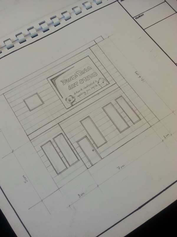
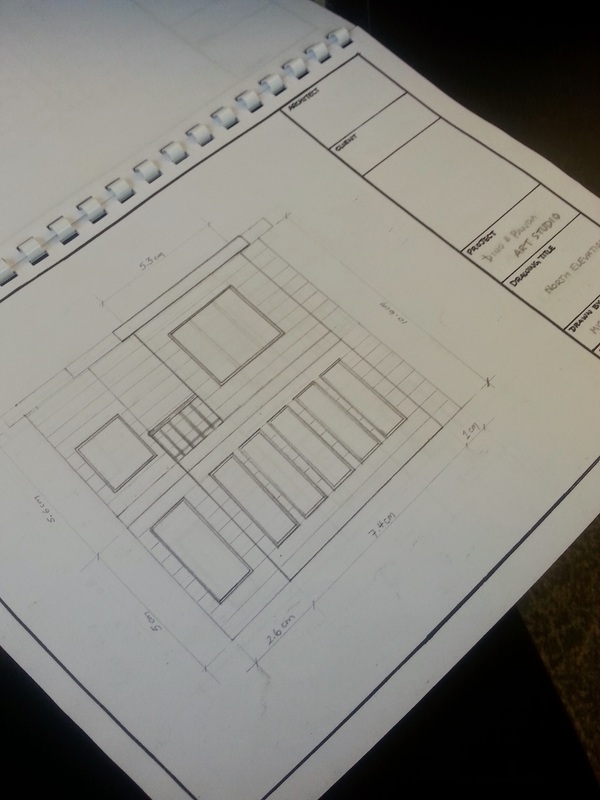
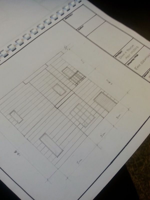
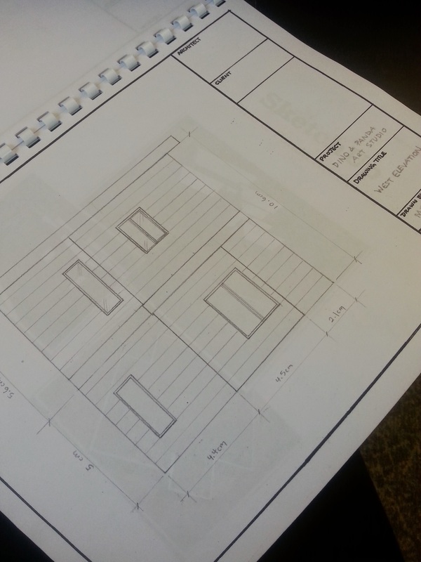
Elevations
Hand-drawn elevations. This was another challenge to the girl's spatial perception. Now they needed to be able to visualize the sides of their buildings from the floor plans they had designed. It was a difficult process but all the girls understood it to various degrees. Things got a little hectic towards the end of the project and I didn't have time to take pictures and document all the girls' booklets so the examples below are from my example.
Computer Elevations. To ensure that students would be able to build their models, I took some time to go through all their floor plans and created each of their walls in AutoCAD to be printed and coloured. I tried to adhere to their designs as closely as possible given we weren't working with a specific scale. Originally I wanted them to redraw their elevations and each part of their building with correct measurements on their own, but there wasn't enough time so I thought this would be the best solution. The girls would colour the computer elevations and add details, cut and glue onto cardboard and then cut these out to be taped together for their model. I also photocopied their revised floor plans to be used to build the foundation and ceiling.
